


公司新闻
17.09.2025
04.03.2025
ESL enters strategic partnership bringing Artificial Intelligence solutions to our business
Engineering Surveys Limited’s AI Partnership with Pyramid Ai Engineering Surveys Limited’s strategic collaboration with Pyramid Ai has revolutionised our onsite operations by leveraging their specialized AI solutions tailored for the Architecture, Engineering, and Construction (AEC) industry. As early adopters of their proprietary AI assistants, which provide access to over 2,000 technical and safety documents, we’ve significantly reduced the time spent retrieving technical and compliance information. Additionally, their AI-driven Vision Safety Assessor has strengthened our site safety protocols, ensuring that the correct safety procedures are consistently followed. This partnership has delivered measurable benefits, including improved safety standards, cost reductions in technical and safety compliance reviews, and a notable boost in productivity across our operations. By continuing to collaborate with Pyramid Ai, we are positioning ourselves at the forefront of the industry—harnessing AI to enhance efficiency, improve safety, and enable our surveyors and engineers to focus on more strategic and value-driven work. If you would like to hear more, please reach out to us or Pyramid AI at https://www.pyramidai.io/
29.04.2024
Congratulations to Patrick, now a Chartered Land Surveyor
Congratulations to Patrick Kan who has recently been elected as a professional member of the RICS.
23.01.2024
ESL added to CAD list of Advanced Operations Permit Holders
ESL are happy to be added to the Civil Aviation List of Advanced Operations Permit Holders. The List can be found @ https://www.cad.gov.hk/documents/AOP_Holders.pdf
15.01.2024
ESL awarded Lantau Island Independent Geotechnical Monitoring Consultancy by MTRC
ESL are happy to announce the award of Consultancy Contract NEX/1110 “Independent Geotechnical Monitoring for Lantau” covering Tung Chung Extension, Oyster Bay Station projects with an Option for ARO Over Run Tunnel. ESL, as Lead Consultant, are pleased to be working again with Maxwell Geosystems on this, our 5th IMC Contract.
25.05.2023
20.10.2022
Notice of Office Relocation
Dear Our Valued Clients, Partners and Potential Customers, Please be informed that due to business expansion our company shall be relocating to a larger office located close to our current office in Cheung Sha Wan (see details below). Our new office is conveniently located a short walk from Lai Chi Kok MTR providing easy access to clients and is housed in a newly completed development. With effect from 01st November, 2022 Our New office address is: Unit 03 & 05, 20th Floor, Peninsula Tower, No. 538-548 Castle Peak Road, Cheung Sha Wan, Kowloon, HK The main telephone no. (852) 2450 4088,mfacsimile no. (852) 2450 4663 & email addresses remain unchanged. During the relocation period, should you encounter any difficulties in contacting us via email and land-lines, please contact the person’s mobile phone number directly. I would like to express our continued gratitude and sincere thanks for all the support and cooperation you have given us over the past years. We look forward to a continued and prosperous relationship with our clients and partners in business, and wish you all the best in the coming year. Yours Sincerely. Gordon Ferrier FRICS, MHKIS, MHKinstES, RPS(Land Survey), CIC Certified BIM Manager Director
13.10.2022
Delivery of NavVis VLX 2nd Generation Mobile Scanner
Engineering Surveys have recently taken delivery of a 2nd Generation NavVis VLX Mobile Scanning System and have put it to work on two current projects. The results to date are extremely impressive both in terms of the absolute point cloud accuracy and the resolution achievable in a short observation period. The “richness” of the point cloud and lack of noise makes the output extremely easy to use for Scan to CAD or Scan to BIM applications…… More to follow.
21.09.2022
Passing Off by Newly Created Company
It has come to our attention that a company has recently been registered with a very similar name to our own. This company has been passing off the work of Engineering Surveys Limited as their own via a marketing flyer which claims experience and a history of work over a period of some 10 years which they have no right to do. We have demanded via a legal letter that this unprofessional practice cease immediately and assurances that it will not be repeated in the future.We have to this date received no assurances as demanded and have therefore written to our clients, partners and colleagues to make them aware of this situation. We further reserve the right to take further action, both legal and professional as required. Declaration for Passing off Company
15.08.2022
Congratulations to Mike, now a Chartered Land Surveyor
Congratulations to Mike Au who has recently been elected as a member of the RICS.
11.09.2021
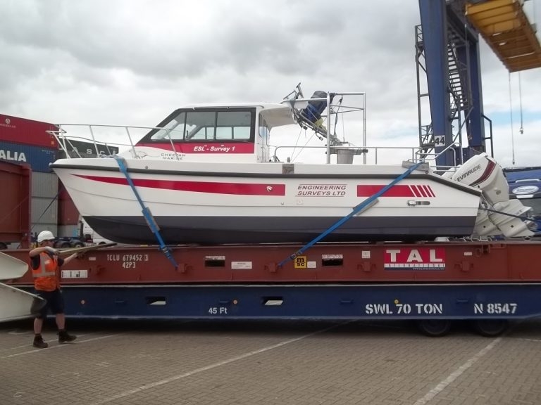
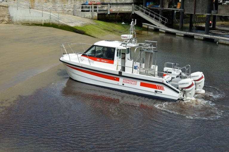
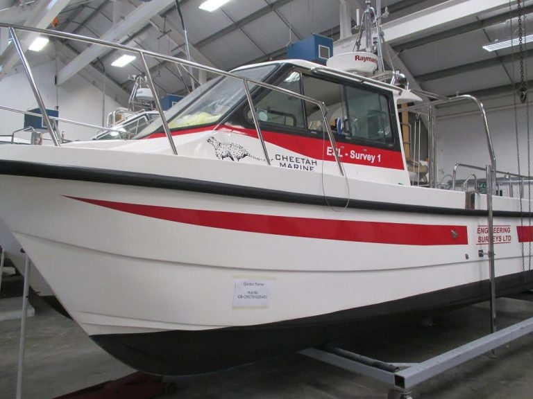
ESL Survey 1 Containerised for deployment anywhere
ESL Survey 1 can now be Containerised on a 20 foot Unit. This can be transported by standard container ship and on a normal sized Crane Lorry. This provides mobility for deployment anywhere at short notice. The Boat is an inshore shallow draft Catamaran with a full suite of Navigation, Bathymetric and Geophysical Sensors. Anywhere a 20 foot container can go our Survey Vessel can deploy. Along with experienced Crew and Technicians we offer a bespoke solution where previously only single beam boats could be used. Please use our enquiry email for a proposal and quote.
23.11.2020
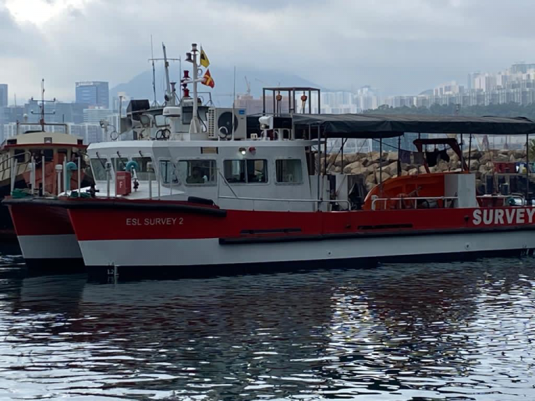
ESL Survey 2 Annual Hull Cleaning
ESL Survey 2 with a new coat of paint
20.07.2020
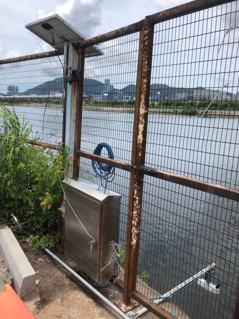
使用太阳能板安装新的雷达潮汐表
我们的水电团队最近安装了新雷达式潮汐计,以提供即时潮汐资讯。 潮汐数据即时上传到安全网页,同时透过太阳能板供电。
02.07.2020
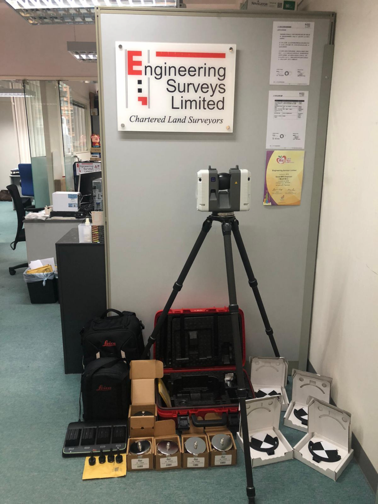
ESL交付的最新的徕卡RTC360扫描仪,这是市场上最快的测量级设备
6月底,我们接收了新的RTC360地面雷射扫描器。 这是市面上最快的专业测量级扫描仪,每秒2,000,000点,完整的半球形扫描需要2分钟。 此次购买意味着我们现在将有2台Leica扫描仪和2台Faro扫描仪,无论是在硬体功能还是在软体适用性方面,都可以与任何项目的最佳扫描器相匹配。
04.06.2020
香港建造业议会(政府机构)认证的BIM专案管理经理
ESL董事长Gordon Ferrier获得香港建造业议会BIM专案管理经理认证的。 这将有助于建立需要认证BIM经理目管理的专案。香港建造业议会目前是香港的认证机构。
26.02.2020
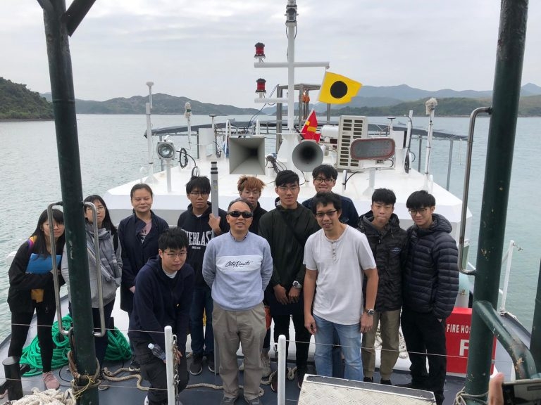
香港理工大学海道测量训练营
公司团队Paul, Jaden和Matthew最近于西贡, “ ESL二号测量船”上主办了理工大学海道测量训练营。 儘管有不合时宜的病毒,营地仍按计划进行,並为所有人所喜爱。

21.02.2020
ESL二号测量船正在维多利亚港进行的移动检查
10.02.2020
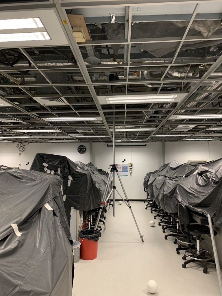
高层扫描器安装座
ESL最近测试了一种高层(可达6m)的扫描器支架,用于扫描天花板空间的机电。可与ReCap“ Realview”结合使用,这对BIM建模有很大的帮助。
10.02.2020
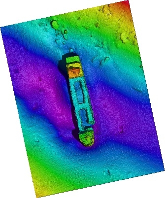
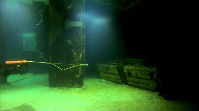
超高解析度多光束
使用我们的超高分辨率MBES在维多利亚港的25米深度处发现一只沉船。
10.02.2020
“ESL二号测量船” 到达香港
经过18个月的设计和在广州建造,「 ESL二号测量船」已完成交付工作。 凭藉40平方公尺的后甲板,多个感测器支架和发射/回收系统,使ESL可以部署比「 ESL一号测量船」更广泛的测量系统。我们的第一艘船仍将用于浅水测量,而如果需要多种感测器选项,例如多光束,无人机照相法和雷射扫描,则应使用二号测量船。 还有更多后续活动…
30.11.2018
RICS / HKIS重新开始相互认证
RICS和香港测量师学会(HKIS)共同宣布,今天(11月29日)两个组织的专业人员相互认证。相互认证适用于土地测量组的专业人员。认证的细节如下。 HKIS会员被接纳为RICS专业人士 HKIS土地测量师(FHKIS和MHKIS)的专业成员应向RICS申请后可被接纳为RICS的专业成员(特许土地测量师(MRICS))並成为Geomatics专业组的成员,並有权RICS成员的所有特权受以下条件限制: A. 取得资格一年后,成为HKIS土地测量部门的专业会员,並从事与地理测量专业相关的专业实践;和 B. 申请前成功完成RICS道德评估; C. 由RICS酌情进行的专业面试,以验证申请人的能力和是否适合加入Geomatics专业小组。 RICS专业人士入选HKIS会员 RICS的专业会员(FRICS和MRICS)具有特许土地测量师的资格,其主要执业地点在香港,可应向HKIS提出的申请被接纳为土地测量师的HKIS(MHKIS)的专业会员,並且可以是有权享有HKIS会员资格的所有特权,包括使用专业测量师的指定和指定称呼,但必须:称呼 A. 与香港测量师学会土地测量师相关的香港特许土地测量师资格及专业从业一年后;和 B. 由HKIS进行的专业面试,以验证申请人的能力和是否适合进入该部门。 这种成员资格的相互承认不适用于HKIS土地测量部门或RICS Geomatics专业组的任何专业成员,而这些成员是透过与其他专业机构的互惠协议而被接纳的。 成员资格的这种相互认可为专业测量师资格证书的申请流程提供了简化,这将使测量专家能够在本地和全球市场上进行实践,並最终丰富他们的经验並提高其在世界范围内的专业地位。 有关申请的详细资讯和查询,请透过以下地址与RICS香港办事处联络:e:ricshk@rics.org或电话:+852 2537 7117;或HKIS办事处电邮:memdept@hkis.org.hk或电话:+852 2526 3679。 Clare Chiu大中华区营运长
31.10.2018
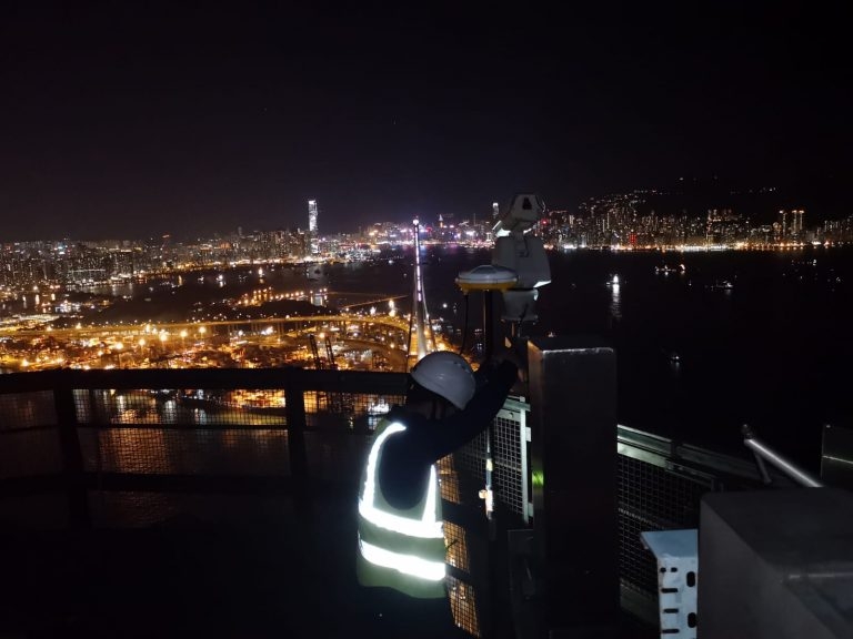
昂船洲大桥配置测量
Edward and Mike于2018年10月30日进行了昂船洲大桥塔顶GNSS配置测量。这是一个美丽的夜晚,几乎沒有污染,如下图所示。
30.10.2018
青洲无人机现实捕捉与雷射扫描
ESL最近完成了青洲遗址的资料收集。 这涉及无人机摄影测量和雷射扫描的整合。 收到民航局飞行许可证后,在4天内完成了空中和陆地资料的撷取。 BIM模型的生产正在进行中。
26.07.2018
新USM安装调试
我们的水文团队已成功使用Reson TP-50多光束,Octans 3000 IMU和Trimble GNSS调试並测试了新的通用声纳支架(USM)。
16.03.2018
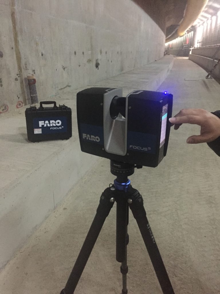
新型FARO S150雷射扫描仪的交付
我们的新型Faro S150雷射扫描器已经到货並投入使用。 Leica P20扫描器体积小巧,移动性强,与我们的Faro Freestyle结合在一起,为我们选择合适的工具提供了极大的灵活性。 雷射扫描和BIM扫描目前是ESL不断成长的市场领域

30.01.2018
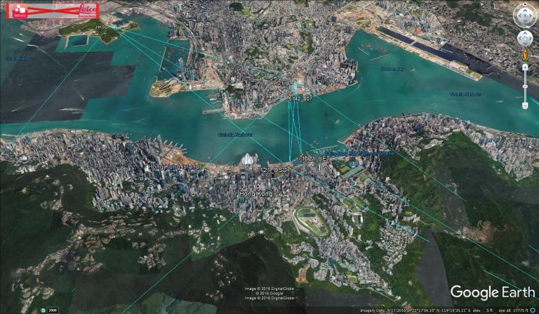
1121合约进展
「 ESL一号测量船」与即将沉管的最后一截预制单元E11並排。
04.12.2017
3RD跑道合约
ESL已被香港机场管理局授予3117号合约「独立的地球物理海底测量服务」。 Rosemary Quinn博士将领导此专案团队。
10.11.2017
香港政府推动BIM的采用
20.10.2017
ESL成功过渡到ISO 9001:2015
在成功过渡到ISO 9001:2015(原为9001:2008)之后,今天收到了电子证书。以下是国际标准组织(ISO)所制定的ISO 9001:2015的基本目标: ISO 9001:2015规定了组织在下列情况下对品质管理系统的要求: a)需要证明其持续提供满足客户以及适用的法律法规要求的产品和服务的能力,並且 b)旨在透过系统的有效应用来提高客户满意度,包括改进系统的过程以及确保符合客户要求和适用的法律法规要求。 ISO 9001:2015的所有要求都是通用的,旨在适用于任何组织,无论其类型或规模或其提供的产品和服务。 感谢香港品质保证局,Paul Chan和我们所有为这项显着成就提供帮助的员工。 以下是我们结合此更改的修订徽标。
15.10.2017
2020年的施工–对测量员来说有什么意义
请阅读美国建筑公司“ Bechtel”的以下文章 http://www.bechtel.com/about-us/innovation/project-2020/ 他们预测,到2020年,随着人工智能和无人机的采用,建筑将朝着自动化的方向发展。 这种传感器依靠精确的地理空间定位,这对像我们这样的公司来说是极为有利的。
14.10.2017
PAUL CHAN被任命为“合伙人”
Paul Chan于今年初被任命为我们的第一位「合伙人」。我们的目的是使用「合作伙伴」模式(与其他专业服务公司共同)来鼓励企业内充满活力的,不断进取的文化。
13.10.2017
专业资格更新
ESL董事长(Gordon Ferrier)先生最近被选为皇家特许测量师学会(RICS)资深会员。 Tina Tang 有 recently submitted her applications to begin her APC to both the RICS and HKIS. meanwhile.. Mike Au is currently preparing his critical analysis…..WATCH THIS SPACE
14.09.2017
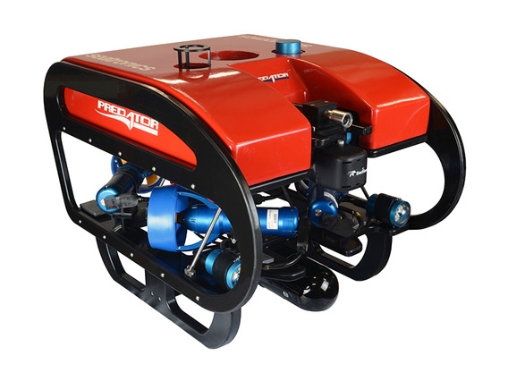
ESL采购观察型ROV
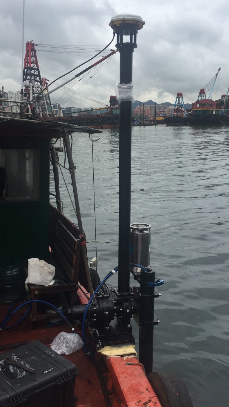
ESL最近购买了Seatronics Predator观察型ROV,以添加到我们的Hydrographic套件中。 它可用于深度达300公尺的水下检查,补充我们现有的多光束和单光束测量能力。 在新加坡的Seatronics办公室进行了ROV培训,Paul,Mike和Mathew参加了培训。请透过klchan@engsurveys.com.hk与Paul Chan联系,以获取详细资讯和/或报价。 除了我们的Tidemaster压力感测器潮汐计外,我们还购买Tidemaster雷达感测器,可在无法部署压力感测器的情况下自动读取潮汐读数。 与压力感测器类型一样,校准后的海平面即时在缐上传。
24.06.2017
水下砾石自动铺设的导航系统
ESL公司最近完成了水下砾石自动铺设的导航和控制系统的调试。 还有更多后续活动…。
14.04.2017
点云视觉化工具
ESL目前正在使用点云视觉化工具,以便与客户分享扫描数据,並允许客户跟进进度。 这里查看点云
29.01.2017
ESL购买LEICA INFINITY软体
ESL最近购买了Leica Infinity软体,以取代Leica GeoOffice。 Infinity让我们可以使用GPS / Glonass / Gallileo / Baidou和QZ卫星资料处理GNSS资料。