


News
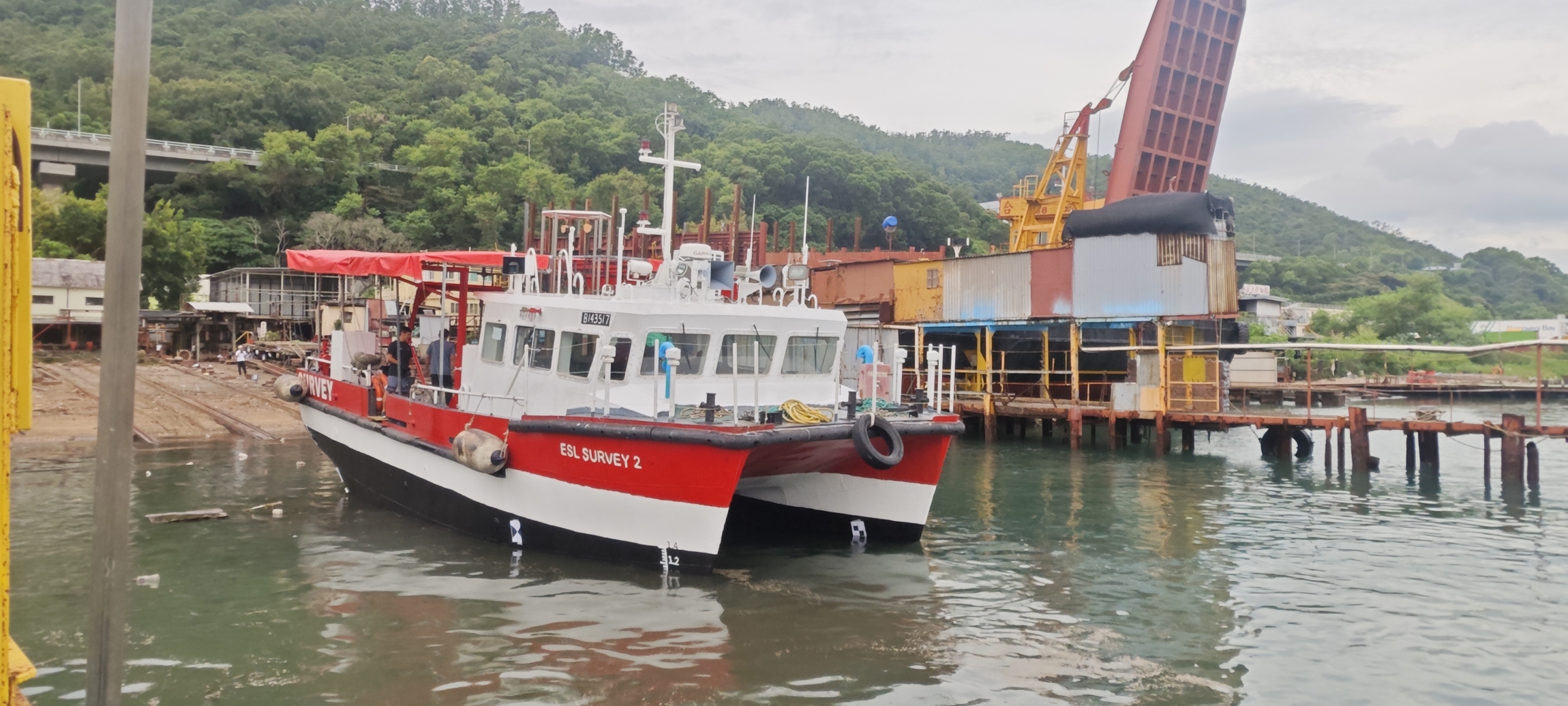
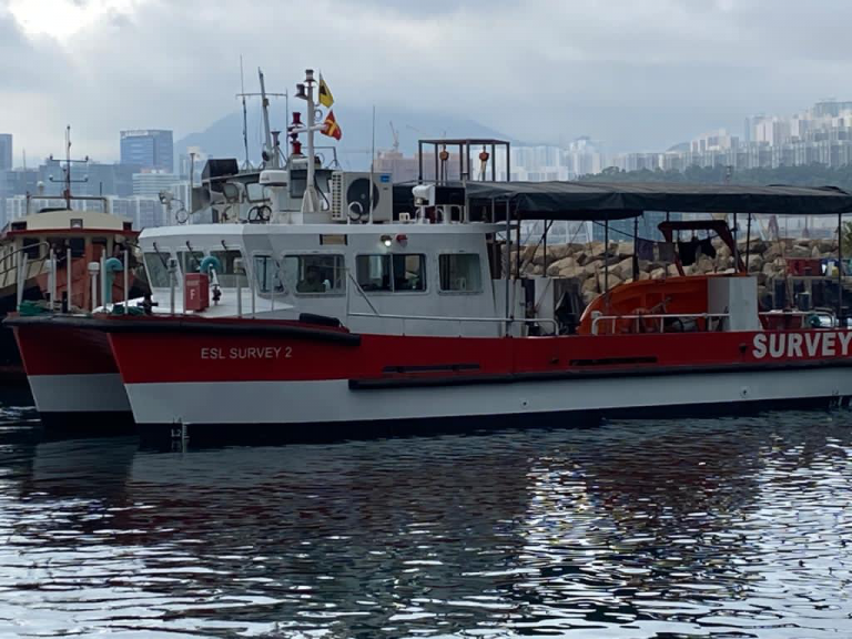
17.09.2025
ESL Survey 2 on slipway for annual inspection. Click for Image.
04.03.2025
ESL enters strategic partnership bringing Artificial Intelligence solutions to our business
Engineering Surveys Limited’s AI Partnership with Pyramid Ai Engineering Surveys Limited’s strategic collaboration with Pyramid Ai has revolutionised our onsite operations by leveraging their specialized AI solutions tailored for the Architecture, Engineering, and Construction (AEC) industry. As early adopters of their proprietary AI assistants, which provide access to over 2,000 technical and safety documents, we’ve significantly reduced the time spent retrieving technical and compliance information. Additionally, their AI-driven Vision Safety Assessor has strengthened our site safety protocols, ensuring that the correct safety procedures are consistently followed. This partnership has delivered measurable benefits, including improved safety standards, cost reductions in technical and safety compliance reviews, and a notable boost in productivity across our operations. By continuing to collaborate with Pyramid Ai, we are positioning ourselves at the forefront of the industry—harnessing AI to enhance efficiency, improve safety, and enable our surveyors and engineers to focus on more strategic and value-driven work. If you would like to hear more, please reach out to us or Pyramid AI at https://www.pyramidai.io/
29.04.2024
Congratulations to Patrick, now a Chartered Land Surveyor
Congratulations to Patrick Kan who has recently been elected as a professional member of the RICS.
23.01.2024
ESL added to CAD list of Advanced Operations Permit Holders
ESL are happy to be added to the Civil Aviation List of Advanced Operations Permit Holders. The List can be found @ https://www.cad.gov.hk/documents/AOP_Holders.pdf
15.01.2024
ESL awarded Lantau Island Independent Geotechnical Monitoring Consultancy by MTRC
ESL are happy to announce the award of Consultancy Contract NEX/1110 “Independent Geotechnical Monitoring for Lantau” covering Tung Chung Extension, Oyster Bay Station projects with an Option for ARO Over Run Tunnel. ESL, as Lead Consultant, are pleased to be working again with Maxwell Geosystems on this, our 5th IMC Contract.
25.05.2023
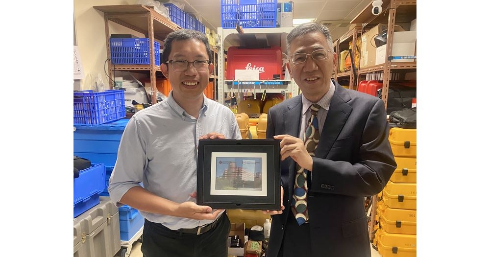
ESL Donate Survey Equipment to Polytechnic University
Prof. Wu Chen presents Certificate of Appreciation to ESL following our donation of Survey Equipment to the University. Link below: https://www.polyu.edu.hk/lsgi/news-and-events/news/2023/0504-esl-hong-kong-limited-has-kindly-donated-eight-total-stations-and-eight-digital-levels/
20.10.2022
Notice of Office Relocation
Dear Our Valued Clients, Partners and Potential Customers, Please be informed that due to business expansion our company shall be relocating to a larger office located close to our current office in Cheung Sha Wan (see details below). Our new office is conveniently located a short walk from Lai Chi Kok MTR providing easy access to clients and is housed in a newly completed development. With effect from 01st November, 2022 Our New office address is: Unit 03 & 05, 20th Floor, Peninsula Tower, No. 538-548 Castle Peak Road, Cheung Sha Wan, Kowloon, HK The main telephone no. (852) 2450 4088,mfacsimile no. (852) 2450 4663 & email addresses remain unchanged. During the relocation period, should you encounter any difficulties in contacting us via email and land-lines, please contact the person’s mobile phone number directly. I would like to express our continued gratitude and sincere thanks for all the support and cooperation you have given us over the past years. We look forward to a continued and prosperous relationship with our clients and partners in business, and wish you all the best in the coming year. Yours Sincerely. Gordon Ferrier FRICS, MHKIS, MHKinstES, RPS(Land Survey), CIC Certified BIM Manager Director
13.10.2022
Delivery of NavVis VLX 2nd Generation Mobile Scanner
Engineering Surveys have recently taken delivery of a 2nd Generation NavVis VLX Mobile Scanning System and have put it to work on two current projects. The results to date are extremely impressive both in terms of the absolute point cloud accuracy and the resolution achievable in a short observation period. The “richness” of the point cloud and lack of noise makes the output extremely easy to use for Scan to CAD or Scan to BIM applications…… More to follow.
21.09.2022
Passing Off by Newly Created Company
It has come to our attention that a company has recently been registered with a very similar name to our own. This company has been passing off the work of Engineering Surveys Limited as their own via a marketing flyer which claims experience and a history of work over a period of some 10 years which they have no right to do. We have demanded via a legal letter that this unprofessional practice cease immediately and assurances that it will not be repeated in the future.We have to this date received no assurances as demanded and have therefore written to our clients, partners and colleagues to make them aware of this situation. We further reserve the right to take further action, both legal and professional as required. Warning Letter Issued to newly created company (ESG)
15.08.2022
Congratulations to Mike, now a Chartered Land Surveyor
Congratulations to Mike Au who has recently been elected as a member of the RICS.
11.09.2021
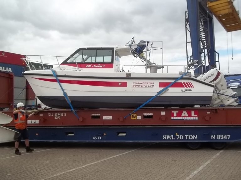
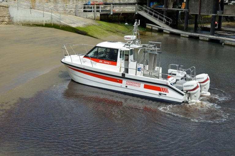
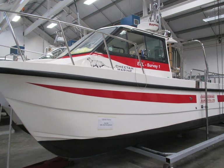
ESL Survey 1 Containerised for deployment anywhere
ESL Survey 1 can now be Containerised on a 20 foot Unit. This can be transported by standard container ship and on a normal sized Crane Lorry. This provides mobility for deployment anywhere at short notice. The Boat is an inshore shallow draft Catamaran with a full suite of Navigation, Bathymetric and Geophysical Sensors. Anywhere a 20 foot container can go our Survey Vessel can deploy. Along with experienced Crew and Technicians we offer a bespoke solution where previously only single beam boats could be used. Please use our enquiry email for a proposal and quote.
23.11.2020
ESL Survey 2 Annual Hull Cleaning
ESL Survey 2 with a new coat of paint
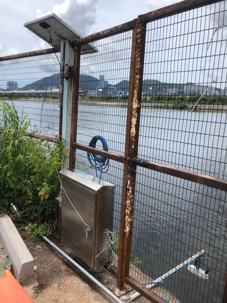
20.07.2020
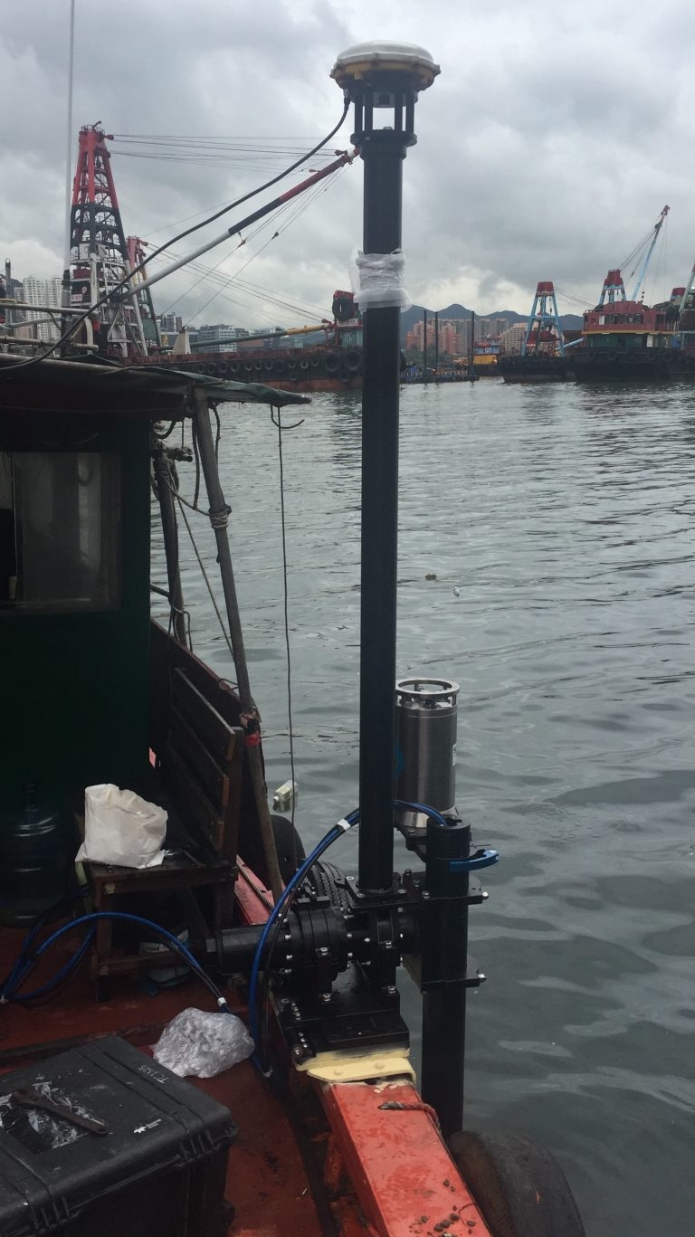
Installation of New Radar Tide Gauge with Solar Panel
Our Hydro team have recently installed a new Radar Type Tide Gauge to provide real time tidal information. The Tide Data is uploaded to a secure web page in real time while power is provided via a solar panel.
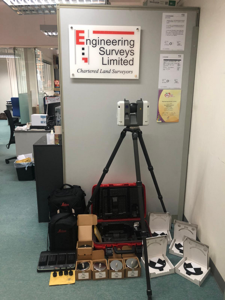
02.07.2020
ESL take delivery of our new Leica RTC360 Scanner, the fastest Survey Grade device on the market
At the end of June we took delivery of our new RTC360 Terrestrial Laser Scanner. This is the fastest survey grade scanner on the market at 2,000,000 points per second with a complete dome scan taking 2 minutes. This new purchase means we now carry 2 Leica and 2 Faro scanners and can match the best one for any project both in terms of hardware capability and software suitability.
04.06.2020
CIC Certified BIM Manager
ESL Director Gordon Ferrier has been added to the list of CIC Certified BIM Managers. This will assist in projects where the BIM component requires a Certified Manager. CIC are currently the certifying body in HK.
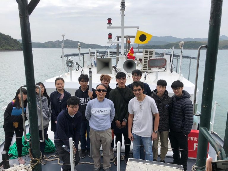
26.02.2020
HK Polytechnic University Hydrographic Survey Camp
Paul, Jaden and Matthew recently hosted the Polytechnic University survey camp in Sai Kung on board “ESL Survey 2”. Despite the untimely Virus the camp went ahead as scheduled and was enjoyed by all.

21.02.2020
ESL Survey 2 Undergoing Mobilisation Checks in Victoria Harbour
10.02.2020
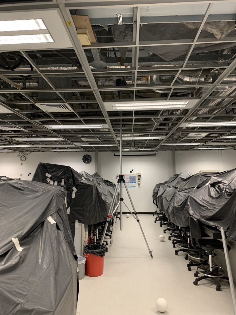
High Level Scanner Mount
ESL Have recently tested a high level (up to 6m) scanner mount for scanning MEP ceiling space’s. Combined with ReCap “Realview” this is a great assistance to BIM modelling.
10.02.2020
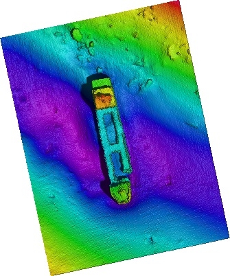
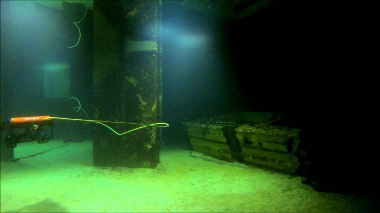
Ultra High Resolution Multi Beam
Shipwreck in Victoria Harbour captured at a depth of 25m using our Ultra High Resolution MultiBeam.
10.02.2020
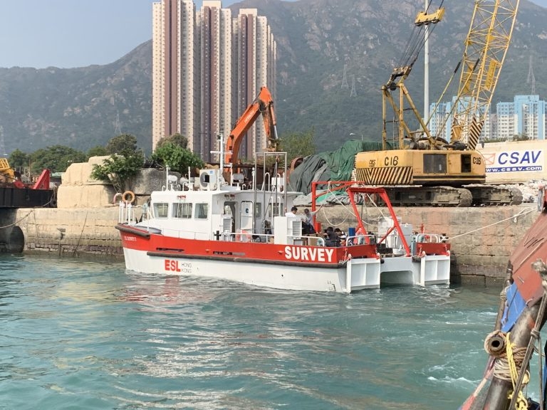
ESL Survey 2 arrives in Hong Kong
After 18 months Design and Construction in Guangzhou “ESL Survey 2” has been delivered. With a 40 square meter back deck, multiple sensor mounts and launch/recovery systems this vessel allows ESL to deploy a wider range of survey systems than could be accommodated on ESL Survey 1. Our first boat shall still be used for shallow water surveys while “Survey 2” shall be utilised where multiple sensor options such a Multi-Beam, UAV Photogrametry and Laser Scanning are required. More to follow…
30.11.2018
RICS/HKIS Mutual Recognition now restarted
RICS and the Hong Kong Institute of Surveyors (HKIS) jointly announce a mutual recognition of membership for professionals of the two organisations today (29 November). The mutual recognition is applicable to professionals from geomatics professional group. Details of the recognition are as follows. HKIS members to admit as RICS professionals Corporate members of the Land Surveying Division of HKIS (FHKIS and MHKIS) may upon application to RICS be admitted as a professional member of RICS (Chartered Land Surveyor (MRICS)) and be a member of the Geomatics Professional Group, and may be entitled to all the privileges of RICS membership subject to: a. one year post-qualification as a Corporate member of the Land Surveying Division of HKIS and professional practice relevant to the geomatics profession; and b. the successful completion of the RICS ethics assessment prior to admission; c. a professional interview conducted at the discretion of RICS to verify the applicant’s competence and suitability for admission to the Geomatics Professional Group. RICS professionals to admit as HKIS members Professional members of RICS (FRICS and MRICS) qualified as a Chartered Land Surveyor, whose principal place of practice being in Hong Kong may upon application to HKIS be admitted as a professional member of HKIS (MHKIS) in the Land Surveying Division, and may be entitled to all the privileges of HKIS membership, including the use of the designation of professional surveyors and the designatory letters, subject to: a. one year post-qualification as a Chartered Land Surveyor and professional practice in Hong Kong relevant to the Land Surveying Division of HKIS; and b. a professional interview conducted at the discretion of HKIS to verify the applicant’s competence and suitability for admission to the Division. This mutual recognition of membership does not apply to any corporate member of the Land Surveying Division of HKIS, or the Geomatics Professional Group of RICS whose admission to membership is by virtue of a reciprocity agreement with another professional body. This mutual recognition of membership offers a streamlined application process for professional surveyor membership qualifications which will allow surveying professionals to practise in both local and global markets, and ultimately benefit their portfolio and raise their professional standing worldwide. For details and enquiries of admission, please contact RICS office in Hong Kong at e: ricshk@rics.org or t: +852 2537 7117; or HKIS office at e: memdept@hkis.org.hk or t: +852 2526 3679. Clare Chiu Chief Operating Officer, Greater China
31.10.2018
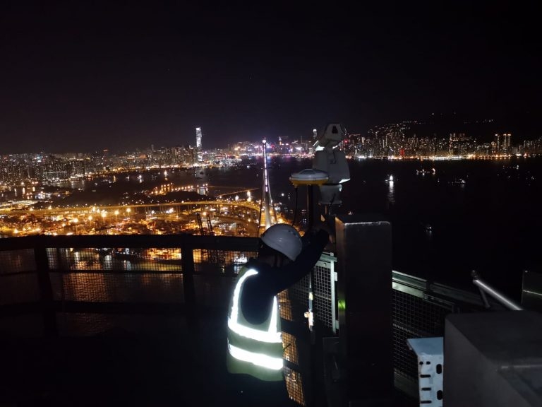
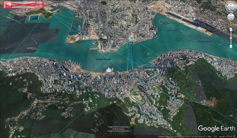
Stonecutters Bridge Configuration Survey
Edward and Mike carried out the SCB Tower Top GNSS configuration survey on 30th Oct 2018. It was a beautiful night with little pollution as can be seen from the photo below.
30.10.2018
Green Island UAV Reality Capture and Laser Scanning
ESL have recently completed the data capture for the Green Island Heritage Site. This involved the integration of UAV photogrammetry and Laser Scanning. Following receipt of CAD flying permit data capture for both Aerial and Terrestrial was completed in 4 days. Production of BIM Model is now ongoing.
26.07.2018
Commissioning of new USM Mount
Our Hydrographic Team have successfully commissioned and tested a new Universal Sonar Mount (USM) using a Reson TP-50 multibeam with Octans 3000 IMU and Trimble GNSS.
16.03.2018
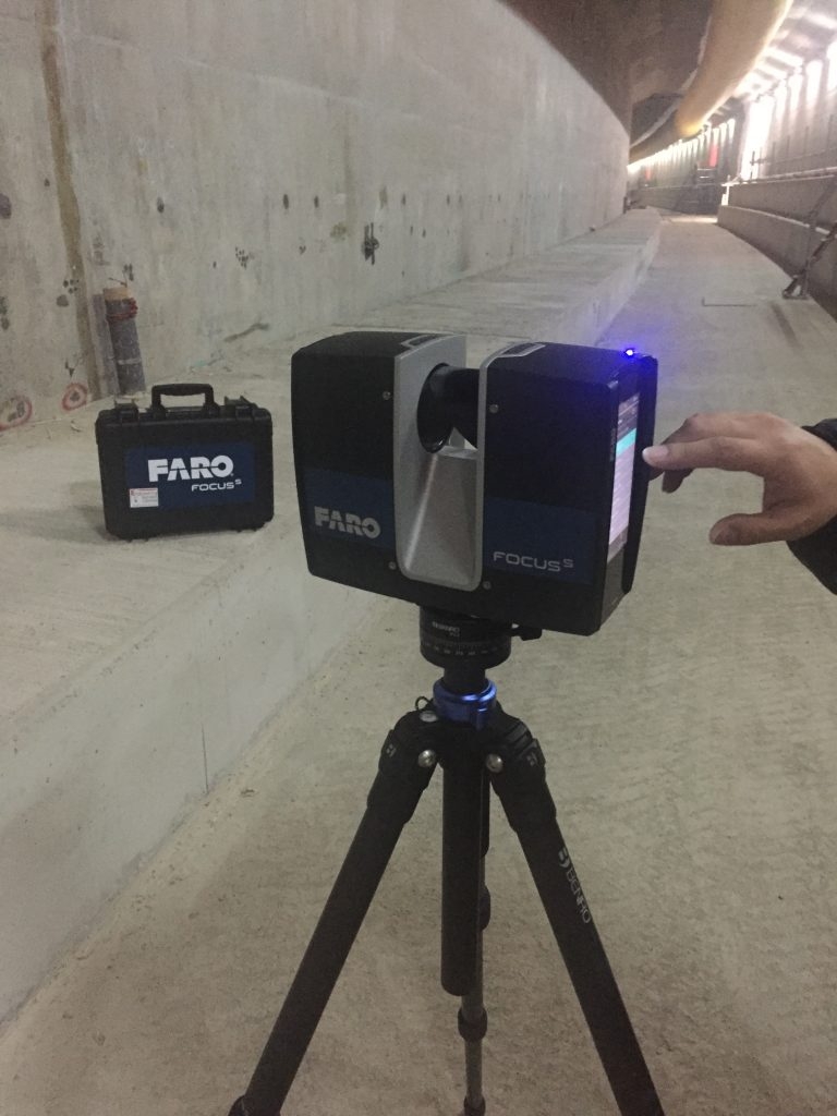
Delivery of new Faro S150 Laser Scanner
Our new Faro S150 Laser Scanner has arrived and has been put to work. It’s small size and mobility complements our Leica P20 scanner which together with our Faro Freestyle gives us great flexibility in choosing the right tool for the job. Laser Scanning and scan to BIM is currently a growing market sector for ESL.

30.01.2018
Contract 1121 progress celebration
Element E11 prior to sinking with “ESL Survey 1” alongside.
04.12.2017
3rd Runway Contract Award
ESL have been awarded Contract 3117 “Independent Geophysical Seabed Survey Services” by HK Airport Authority. Dr Rosemary Quinn shall lead the team on this Project.
10.11.2017
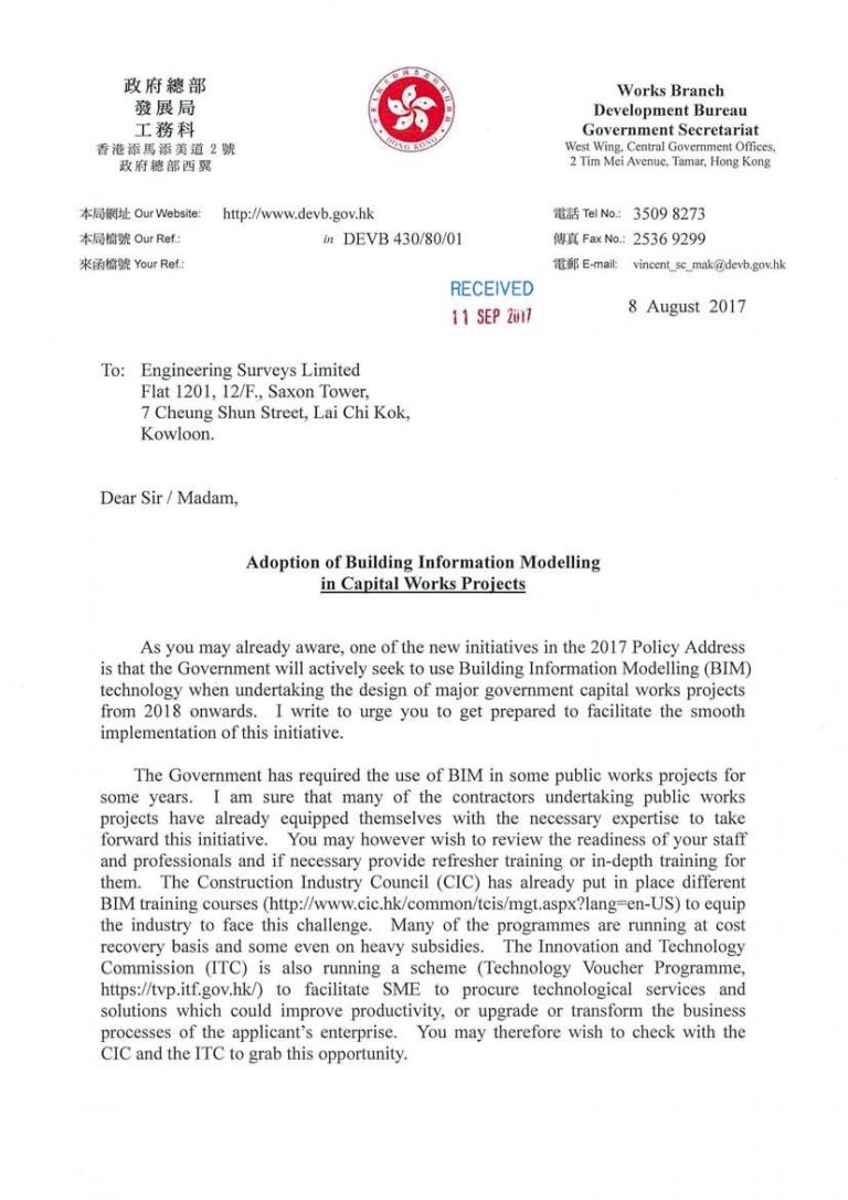
HK Government pushing the adoption of BIM
20.10.2017
ESL Successfully Transition to ISO 9001:2015
Following our successful transition to ISO 9001:2015 (from 9001:2008) we received our soft copy certifcates today. Below are the basic aims of ISO 9001:2015 as set out by the International Standards Organisation (ISO): ISO 9001:2015 specifies requirements for a quality management system when an organization: a) needs to demonstrate its ability to consistently provide products and services that meet customer and applicable statutory and regulatory requirements, and b) aims to enhance customer satisfaction through the effective application of the system, including processes for improvement of the system and the assurance of conformity to customer and applicable statutory and regulatory requirements. All the requirements of ISO 9001:2015 are generic and are intended to be applicable to any organization, regardless of its type or size, or the products and services it provides. Thanks to HKQAA, Paul Chan and all our staff who aided in this notable achievement. Below is our revised Logo incorporating this change.
15.10.2017
Construction in 2020 – what does it mean for Surveyors
Please read the article below from the US construction firm “Bechtel” http://www.bechtel.com/about-us/innovation/project-2020/ They predict that construction will move towards automation by 2020 with the adoption of AI and drones driving this change. Such sensors rely on precise Geospatial positioning which is extremely positive for companies like our own.
14.10.2017
Paul Chan appointed as “Partner”
Paul Chan was appointed as our first “Partner” earlier this year (apologies for the late post).Our intention is to use the “Partner” model (common with other professional service companies) to encourage a dynamic, go ahead culture within the business.
13.10.2017
Professional Qualification Updates
ESL Director Mr Gordon Ferrier has recently been elected as Fellow of the Royal Institute of Chartered Surveyors (RICS) Tina Tang has recently submitted her applications to begin her APC to both the RICS and HKIS. meanwhile.. Mike Au is currently preparing his critical analysis…..WATCH THIS SPACE
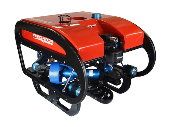
14.09.2017
ESL purchase Inspection class ROV
ESL have recently purchased a Seatronics Predator inspection class ROV to add to our Hydrographic suite. This shall be used for underwater inspections up to 300m depth and shall complement our existing Multi Beam and Single Beam capability. ROV Training has been carried out at Seatronics Office in Singapore with Paul, Mike and Mathew attending. Please contact Paul Chan at klchan@engsurveys.com.hk for details and/or Quotation. As an addition to our Tidemaster pressure sensor Tide Gauge(s) we have also purchased a Tidemaster Radar Sensor allowing automatic Tide Readings where a pressure sensor cannot be deployed. As with the Pressure Sensor type the calibrated sea level is uploaded online in real time.
24.06.2017
Navigation System for underwater gravel spreading
Engineering Surveys have recently completed the provision and commissioning of a navigation and control system for underwater gravel spreading. More to follow….
14.04.2017
Point Cloud Visualiser
ESL are currently using a point cloud visualiser in order to share Scanning data with clients and allow stakeholders to follow progress. View Point Cloud Here
29.01.2017
ESL purchase Leica Infinity
ESL have recently purchased Leica Infinity software, the replacement fot Leica GeoOffice. Infinity allows us to process GNSS data using GPS/Glonass/Gallileo/Baidou and QZ satellite data.