


News
17.09.2025
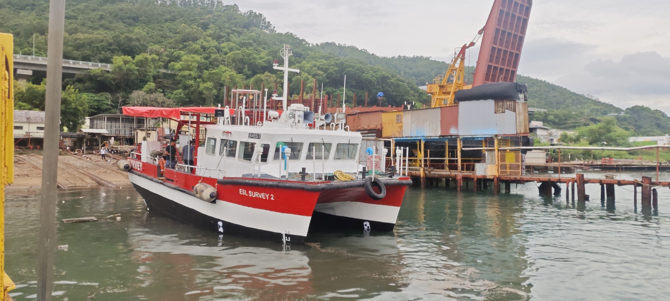
ESL Survey 2 on slipway for annual inspection. Click for Image.
04.03.2025
ESL enters strategic partnership bringing Artificial Intelligence solutions to our business
Engineering Surveys Limited’s AI Partnership with Pyramid Ai Engineering Surveys Limited’s strategic collaboration with Pyramid Ai has revolutionised our onsite operations by leveraging their specialized AI solutions tailored for the Architecture, Engineering, and Construction (AEC) industry. As early adopters of their proprietary AI assistants, which provide access to over 2,000 technical and safety documents, we’ve significantly reduced the time spent retrieving technical and compliance information. Additionally, their AI-driven Vision Safety Assessor has strengthened our site safety protocols, ensuring that the correct safety procedures are consistently followed. This partnership has delivered measurable benefits, including improved safety standards, cost reductions in technical and safety compliance reviews, and a notable boost in productivity across our operations. By continuing to collaborate with Pyramid Ai, we are positioning ourselves at the forefront of the industry—harnessing AI to enhance efficiency, improve safety, and enable our surveyors and engineers to focus on more strategic and value-driven work. If you would like to hear more, please reach out to us or Pyramid AI at https://www.pyramidai.io/
23.01.2024
ESL added to CAD list of Advanced Operations Permit Holders
ESL are happy to be added to the Civil Aviation List of Advanced Operations Permit Holders. The List can be found @ https://www.cad.gov.hk/documents/AOP_Holders.pdf
15.01.2024
ESL awarded Lantau Island Independent Geotechnical Monitoring Consultancy by MTRC
ESL are happy to announce the award of Consultancy Contract NEX/1110 “Independent Geotechnical Monitoring for Lantau” covering Tung Chung Extension, Oyster Bay Station projects with an Option for ARO Over Run Tunnel. ESL, as Lead Consultant, are pleased to be working again with Maxwell Geosystems on this, our 5th IMC Contract.
20.10.2022
Notice of Office Relocation
Dear Our Valued Clients, Partners and Potential Customers, Please be informed that due to business expansion our company shall be relocating to a larger office located close to our current office in Cheung Sha Wan (see details below). Our new office is conveniently located a short walk from Lai Chi Kok MTR providing easy access to clients and is housed in a newly completed development. With effect from 01st November, 2022 Our New office address is: Unit 03 & 05, 20th Floor, Peninsula Tower, No. 538-548 Castle Peak Road, Cheung Sha Wan, Kowloon, HK The main telephone no. (852) 2450 4088,mfacsimile no. (852) 2450 4663 & email addresses remain unchanged. During the relocation period, should you encounter any difficulties in contacting us via email and land-lines, please contact the person’s mobile phone number directly. I would like to express our continued gratitude and sincere thanks for all the support and cooperation you have given us over the past years. We look forward to a continued and prosperous relationship with our clients and partners in business, and wish you all the best in the coming year. Yours Sincerely. Gordon Ferrier FRICS, MHKIS, MHKinstES, RPS(Land Survey), CIC Certified BIM Manager Director
21.09.2022
Passing Off by Newly Created Company
It has come to our attention that a company has recently been registered with a very similar name to our own. This company has been passing off the work of Engineering Surveys Limited as their own via a marketing flyer which claims experience and a history of work over a period of some 10 years which they have no right to do. We have demanded via a legal letter that this unprofessional practice cease immediately and assurances that it will not be repeated in the future.We have to this date received no assurances as demanded and have therefore written to our clients, partners and colleagues to make them aware of this situation. We further reserve the right to take further action, both legal and professional as required. Warning Letter Issued to newly created company (ESG)
15.08.2022
Congratulations to Mike, now a Chartered Land Surveyor
Congratulations to Mike Au who has recently been elected as a member of the RICS.
11.09.2021
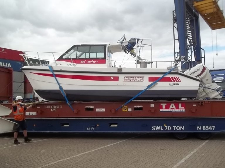
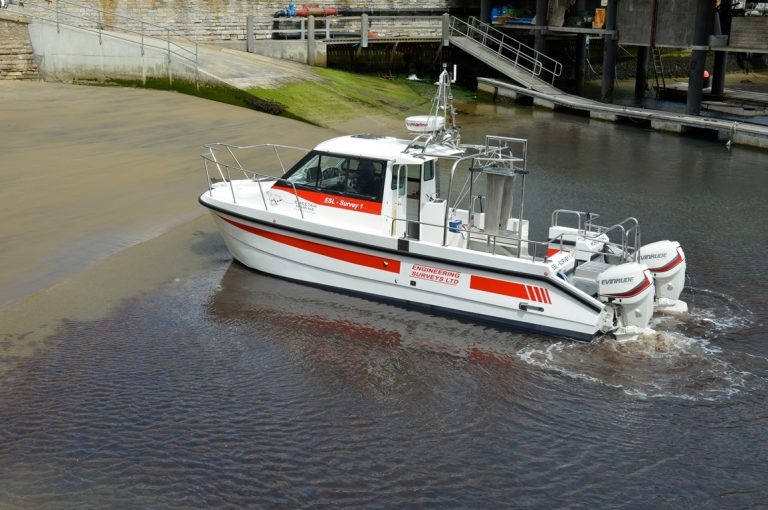
ESL Survey 1 Containerised for deployment anywhere
ESL Survey 1 can now be Containerised on a 20 foot Unit. This can be transported by standard container ship and on a normal sized Crane Lorry. This provides mobility for deployment anywhere at short notice. The Boat is an inshore shallow draft Catamaran with a full suite of Navigation, Bathymetric and Geophysical Sensors. Anywhere a 20 foot container can go our Survey Vessel can deploy. Along with experienced Crew and Technicians we offer a bespoke solution where previously only single beam boats could be used. Please use our enquiry email for a proposal and quote.
23.11.2020
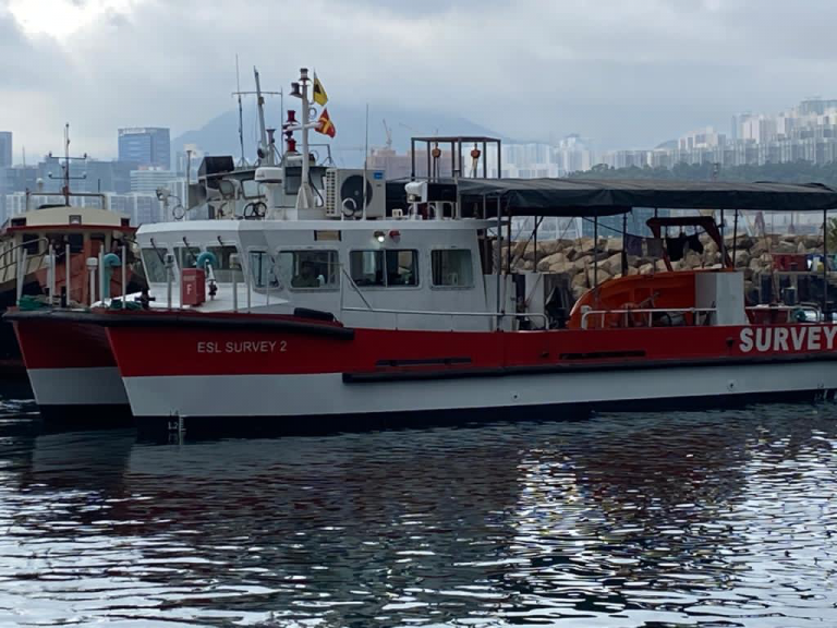
ESL Survey 2 Annual Hull Cleaning
ESL Survey 2 with a new coat of paint
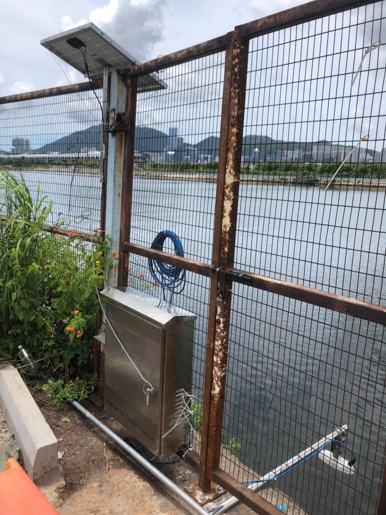
20.07.2020
Installation of New Radar Tide Gauge with Solar Panel
Our Hydro team have recently installed a new Radar Type Tide Gauge to provide real time tidal information. The Tide Data is uploaded to a secure web page in real time while power is provided via a solar panel.
02.07.2020
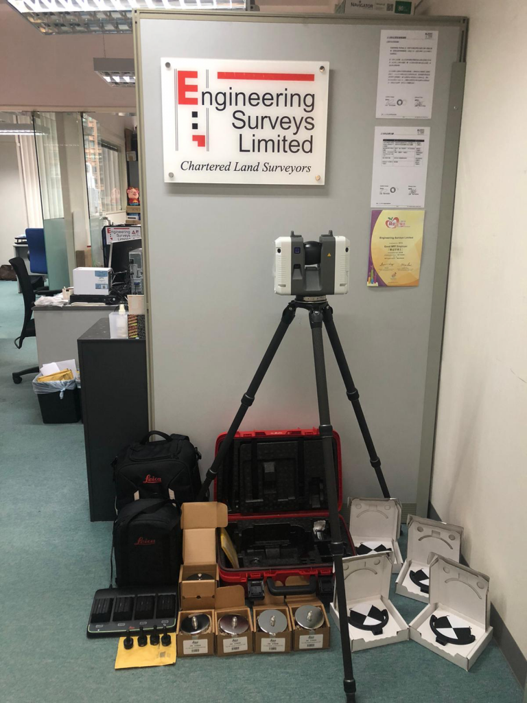
ESL take delivery of our new Leica RTC360 Scanner, the fastest Survey Grade device on the market
At the end of June we took delivery of our new RTC360 Terrestrial Laser Scanner. This is the fastest survey grade scanner on the market at 2,000,000 points per second with a complete dome scan taking 2 minutes. This new purchase means we now carry 2 Leica and 2 Faro scanners and can match the best one for any project both in terms of hardware capability and software suitability.

21.02.2020
ESL Survey 2 Undergoing Mobilisation Checks in Victoria Harbour
10.02.2020
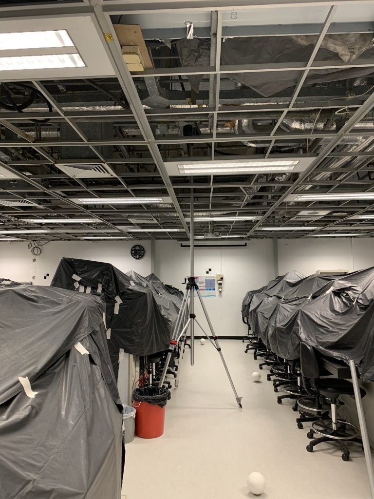
High Level Scanner Mount
ESL Have recently tested a high level (up to 6m) scanner mount for scanning MEP ceiling space’s. Combined with ReCap “Realview” this is a great assistance to BIM modelling.
10.02.2020
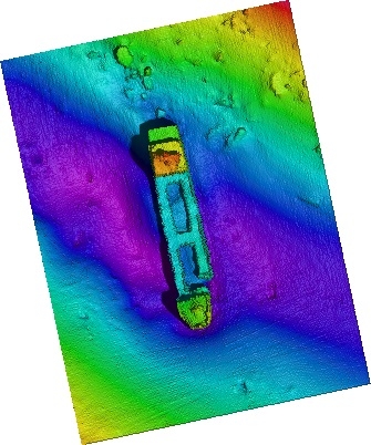
Ultra High Resolution Multi Beam
Shipwreck in Victoria Harbour captured at a depth of 25m using our Ultra High Resolution MultiBeam.